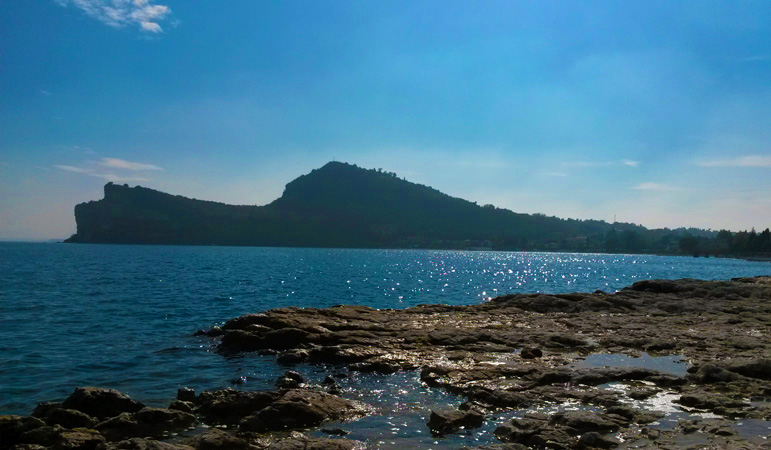
The “Rocca di Manerba” (GPS coordinates: 45.5575° N, 10.5722° E) is a rocky outcrop jutting out into the lakeshore.
It is settled within the protected oasis of the natural park, and it offers a variety of Mediterranean essences and flowers (among others the wild orchids), amazing landscapes, and numerous trails immersed into the wild nature.
At the entrance of the park, there is the Visitors’ Centre: it is an Archaeological Museum that exhibits both the archaeological remains discovered in this area and the natural environment in the surrounding territory.
The rocky wall, which descends vertically into the lake, offers house for birds’ nests – in particular seagulls – and provides an amazing panoramic viewpoint for the whole basin of the lake.
The clearly marked paths allow you to visit the Rocca on all three levels: the lakeshore, the middle level (“la Rocchetta”), and the top (“il Sasso”, where you can also admire the remains of the medieval settlement).
The Photo Gallery dedicates a section to this Natural Area.
Just on the north-western slopes of the Rocca is the island of San Biagio, known by the name of Island of the rabbits, which can be reached by “walking on the water”, thanks to a thin sandy tongue – just under the surface of the water – which connects it to the mainland
During the summer months, the local Alpine Guides Association organises a guided adventurous cave descent from the plateau to the beach: tunnel sections alternating with two rope descents.